≫ Aerial surveying

Capture accurate aerial data across land and sea with our expertise, aircraft fleet and modern sensors. Explore user-friendly insights on 3D models and maps.
≫ Land surveying

Plan, build and maintain buildings, roads, railways and other infrastructure with precision and confidence. Track and monitor accuracy from project start to finish.
≫ Mapping and modelling

From corridor mapping to digital twin solutions, unlock complex geospatial data with accurate 3D maps and models. Plan, build, and maintain assets with confidence and ease.
≫ Mobile mapping & geophysics

Capture and analyze detailed 360-degree information about road conditions, utilities, groundwater, bedrock, and more. Explore insights on interactive software.
≫ Interactive software

Understand what matters with user-friendly geospatial software featuring orthophotos, oblique images, 360 panoramas, and 3D point cloud for mapping and analysis.
≫ Land & property consultancy

Manage and develop land and property in Norway. Acquire properties and property rights, manage building applications and subdivisions, and more.
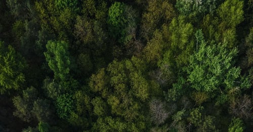
≫ Forest inventory

By combining LiDAR data and aerial imagery with field measurements, we can provide accurate and cost-effective inventory results over large areas.


From data to decisions: Explore how to use geographic data and visualization for smarter project planning

Field strengthens construction innovation as HP’s first certified siteprint provider in the Nordics

Mikko Salonen appointed new CEO of Field Geospatial

Webinar: Mobile Mapping – efficient and precise mapping for infrastructure and construction

Field Expands Leadership in Geospatial Data with Advanced RIEGL Mobile Mapping Technology

Field Hosts Its First Annual Career Day for Students

Field and Maxwell GeoSystems in strategic partnership to bring advanced geo-monitoring Solutions to the Nordic market

Providing safer railway operations by real-time data monitoring

A Day in the Field: Charles de Jongh

New office for Field: Carl Holen embarks on a month-long trek home to Ålesund

A Day in the Field: Tobias Jokisch

Field kickstarts 2024 under new ownership

Best wishes for the festive season

New mobile mapping solution makes managing road networks easier and more efficient

Field strengthens customer data protection with ISO 27001 certification

Updated forest management plans from remote sensing: Orsa, Älvdalen and private owners

The world as seen by birds and fish: Helligvær and Bliksvær are mapped above and under water

Mission Trollstigen: Avalanche risk analysis
.jpg?width=500&name=A%20Day%20in%20the%20Field_%20Paal%20Dahl..%20fi%20(2).jpg)